A
A
A
Now that over 200 million doses of the COVID-19 vaccine have been administered in the US, over half of all American adults have received at least one dose of the shot. This is raising new questions about the official vaccine card given after you receive your first dose. Here is what you need to know about this important little piece of paper.
What to Do with the Vaccine Card After Receiving It
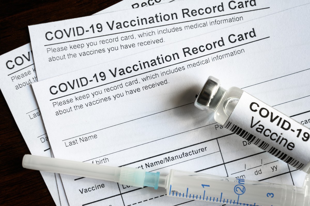
After you receive your first dose of the COVID-19 vaccine, you will also receive the accompanying vaccine card. Issued by the Centers for Disease Control and Prevention (CDC), this card is proof that you received one of the officially approved vaccines. The card indicates what type of vaccine you received, the date that you received it, the lot number of your specific vaccine, and where it was administered to you.
Read More »
After you get home from your first shot appointment, be sure to put the card in a safe place. It is important that you take this card with you to your second appointment. It is also a good idea to take a picture of the card as a backup.
What Happens if You Did Not Receive a Card
Do not fret if you did not receive a vaccine card at your first appointment. The first step is to contact the place where you received the shot. They should have proof that you did indeed receive the dose. You can also reach out to your state health department to get their advice on how to receive a card.
Lose Your Card? Here is What to Do
The CDC recommends that you contact the vaccination provider should you mistakenly misplace your vaccination card. If this is not an option, you can also reach out to your state health department. They are required to keep records of all COVID-19 vaccinations. The CDC website lists contact information for state vaccination contacts.
If you had already enrolled in either the v-safe program or VaxText, these online portals will help you to access your card.
To Laminate or Not
Many people are choosing to laminate their cards to protect them even further. Do not do this until you have received your second vaccination if you are using a two-dose regimen. Once you have laminated it, you will not be able to write on it. Some retailers are offering their lamination services for free for vaccination cards. Staples and Office Depot have both announced that they will laminate cards at no charge. If you do not want to go the lamination route, you can also purchase protective sleeves to guard the card.
Guarding Your Personal Information
While it may be tempting to post a selfie of yourself with your complete card on your social media account, the Better Business Bureau (BBB) is cautioning people to resist this urge. Although you are not giving away all of your personal identifying information with a snapshot of this card, the data may be all that a scammer needs to take advantage of you. For example, scammers can use birth dates to hack all types of sensitive accounts.
This information can also be used to create a fake card. There have already been reports surfacing about counterfeit versions of these vaccination cards. Additionally, by posting portions of your protected health information online, you may be making yourself vulnerable to the invalidation of your Health Insurance Portability and Accountability Act (HIPAA) protection.
Why You May Need This Card
It is becoming more likely that this card will be needed for Americans to participate in a variety of activities in the future. For example, a slew of colleges and universities are already announcing that they are going to require that students be fully vaccinated in the fall. There have also been cruise lines and other travel-related ventures that have mandated that all participants be vaccinated.
Although there is still a lot of uncertainty surrounding how these cards may be used in the future, the important thing to remember for now is to keep them in a safe place.